If you are
MALE and have the necessary permits the hallowed portals of Mount Athos, (also known as Agion Oros, or the 'Holy Mountain'),
will become accessible to you. An edict of the Emperor Constantine Manomachos in the year 1060 (enforced till date), forbids women from setting foot on the peninsula. This stringent exclusion of females applies to domestic animals as well.
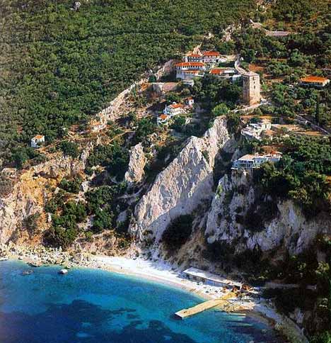
Mount Athos is the oldest surviving monastic community in the world.It is a
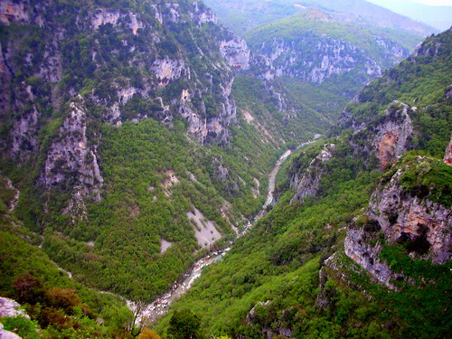
semiautonomous republic of the Greek Orthodox Church and is the eastern-most and most mountainous of the three peninsulas of Halkidiki. It has almost no natural harbours and no lowland areas. The peninsula is traversed by a huge, densely forested mountain mass, which terminates in the rocky s

ummit of Mount Athos (2,033 m high) near the southernmost tip of the peninsula.
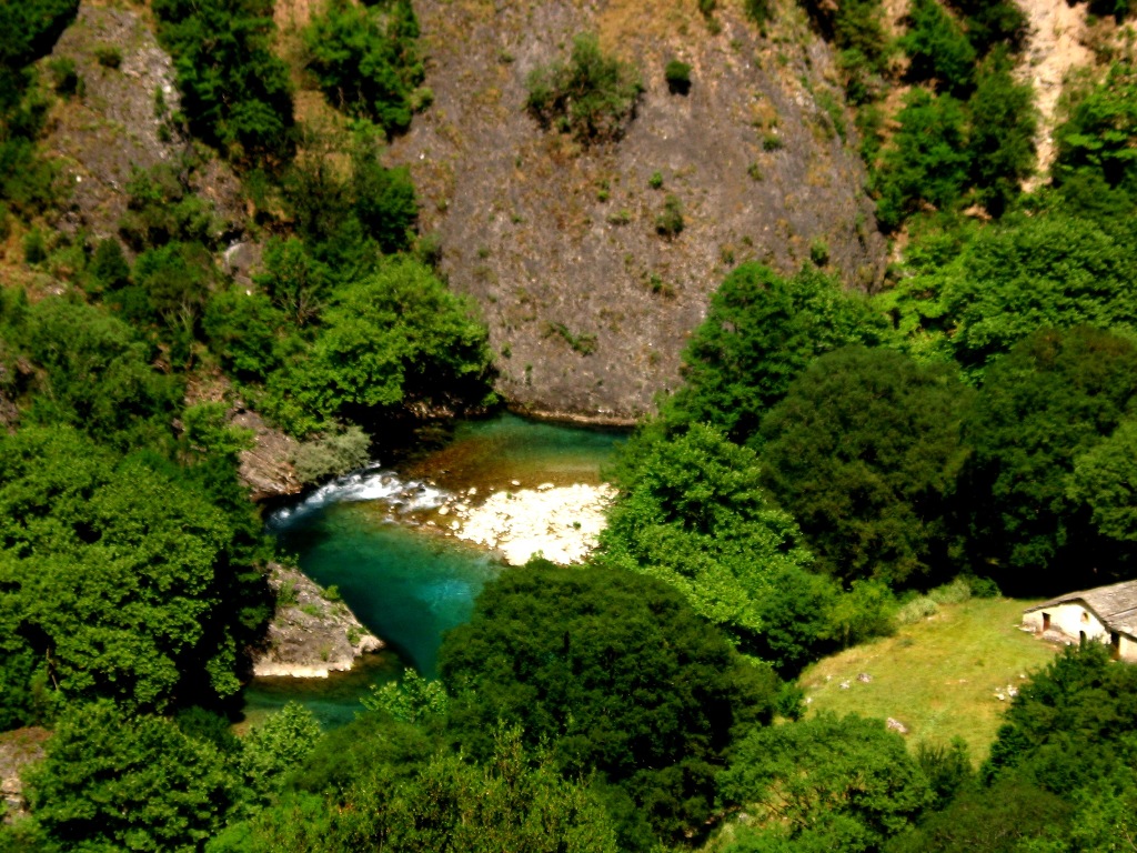
The mountain mass is cleft by deep ravines, along which flow deep torrents and countless streams. The sea is usually rough and in the winter stormy, so that there are many days of the year when it is difficult, if not impossible, to approach the shore.
Because of it's isolation Mount Athos has remained one of the most unspoiled parts of Greece.
A MALE ONLY TERRITORY it is
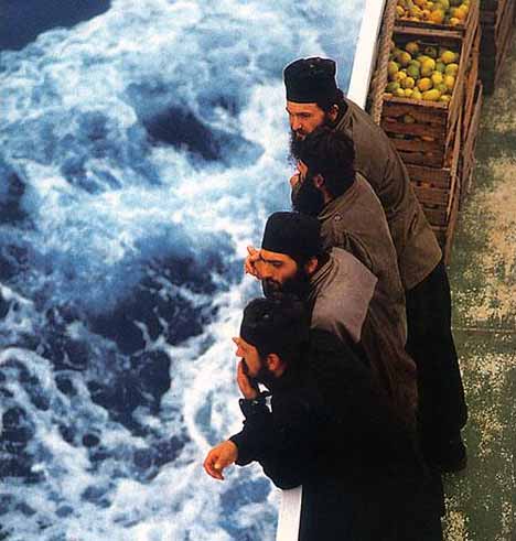
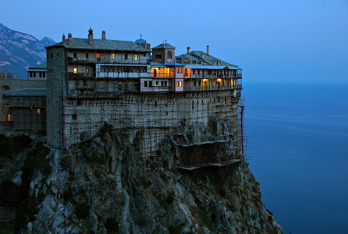
inhabited by around 3000 monks affiliated to the twenty large monasteries with fortified walls, other smaller monastic houses and remote mountain caves.You may find th

e edict anachronistic and patriarchal but if you are male and are keenly interested in history and art, then this is a treasure trove.
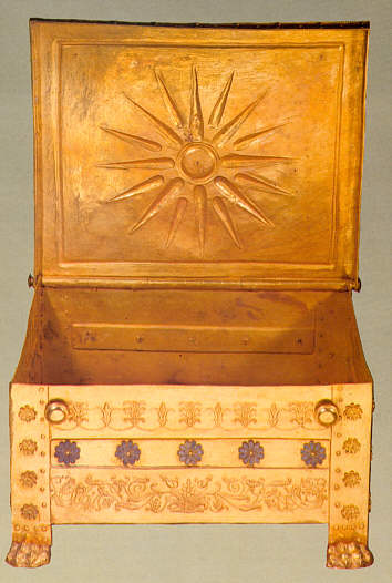
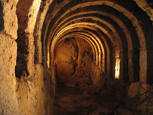
The monastery churches contain some of the finest examples of Byzantine art, icons and treasure. Their libraries hold a vast number of classical and medieval manuscripts.And if you are interested in spiritualism and open to understanding the monastic way of life and how it has been practised through the ages, there is no better place to go. Though a few of the monasteries have electricity, most function as they did in medieval times. The monks grow their own food, spend long hours each day in prayer, and rarely venture out of the peninsula.
Whatever be your reason, once there in Mount Athos, be sure to be sensitive to the demands of the special environment. It is not only a living museum, but it is principally a place for prayer and contemplation, free from external influences.
It is the monastic part of the Byzantine world has been preserved in this remote part and herein lies the timeless beauty of Mount Athos.
The religious history of Athos goes back long before the birth of Christianity. Homer mentions it as being the first home of the Greek gods Zeus and Apollo before Mt. Olympus. Pagan hermits have been known to have lived in the deep forests and mountain caves since prehistoric times. Athos first became a centre for Christian hermits and anchorites in the 6th and 7th centuries, and during the 8th and 9th centuries the hermits began to group together into small monastic communities. The era of the great monastic establishments began with the founding of the Great Lavra on the southeast coast of Athos in 963 AD. Under the protection of the Byzantine emperors, the building of monasteries flourished and at its pinnacle Mt. Athos had 40 monasteries habituated by 20,000 monks. When the Turkish armies captured nearby Thessaloniki in 1430, the monastic community prudently surrendered, thus remaining untouched and relatively autonomous. The long period of Turkish rule brought about a steady decline of the monasteries that was later somewhat alleviated by the patronage of the Russian Czars. In 1926, a decree by the Greek government made the Monks Republic an official part of Greece while allowing it to retain an autonomous theocratic government. Since th
e 1950’s there has been a gradual reawakening of interest in the monastic life
PERMITS:
Any Greek or foreign Orthodox Christian who wishes to visit Mount Athos must first get in touch with the Pilgrim Bureau in Thessaloniki (tel. (++30) 2310 833 733) or Ouranoupolis, Chalkidiki (tel. (++30) 23770 71 423) in order to obtain the
Diamoneterion (visitation permit) which is valid for four calendar days.
Foreigners of other religious affiliations must apply to the Ministry of Foreign Affairs, Directorate of Churches, 2, Zalokosta St, Athens, (tel. (++30) 210 362 6894) or the Ministry of Macedonia and Thrace, Directorate of Political Affairs, Plateia Diikitiriou, Thessaloniki, (tel. (++30) 2310 270 092) in order to obtain an entry permit for Mount Athos.
A maximum of 120 Orthodox Christian visitors are allowed per day, whereas foreigners of other religious affiliations are limited to 14 per day. These limits do not include persons that have explicit invitations from the monasteries.
Source: macedonian-heritage.grHOW TO REACH From Thessaloniki
 -
Reach Ouranoupolis by private automobile or public transportation (KTEL buses of the Prefect of Chalkidiki, 68 Karakasi St., Thessaloniki (tel. (++30) 2310 924 444). There are daily departures to Ouranoupolis and Ierissos at 06:00, 08:30, 10:30, 14:30, 16:30, 18:30. The journey is approximately two hours long.
From Ouranoupolis (tel. (++30) 23770 71 248) there are daily freight and passenger boat trips at 9:45 to Daphne, the sea port of Mount Athos and to the monasteries of Zographou, Docheiariou, Xenofontos and Saint Panteleimon. Visitors to the monasteries of Simonos Petra, Gregoriou, Dionysiou, Saint Paul and the skete of Saint Anne change boats at Daphne. Finally, for the monasteries of Esphigmenou and Vatopedi in particular, the visitor may depart from Ierissos ((++30) 23770 22 576).
From Daphne to Karies,
the capital of Mount Athos, is by bus (35 minutes). From Karies visitors may reach monasteries and sketae by 4WD mini buses or monastery vehicles. (tel. (++30) 23770 23 266, cel phone (++30) 6944 302 451).
Visitors who are serious about touring Mount Athos on foot will probably find the trekking guide written by Mark Dubin useful. Source: macedonian-heritage.grACCOMODATIONRoom and board in the monasteries and sketae is gratis and is valid for up to 24 hours. For the monasteries in particular, one is expected to telephone before visiting. Lodging is also available in small hotels in Daphne and Karyes.Relevant Telephone Numbers of the monasteries available on
macedonian-heritage.grGENERAL GUIDELINES:CLOTHES: Full sleeved top and full sleeved bottom
PHOTOGRAPHY: Use of photographic equipment is allowed across Mount Athos except within monastery interiors. For interior photography the permission of the monastery is required. Cinematography, video recordings and listening to music, as well as photographing monks are expressly forbidden.
OTHER USEFUL LINKSHistory of Mount Athos;
Art of Mount Athos;
Architecture of Mount Athos;
The Monasteries of Mount AthosInternational Status & Legal Framework of Mount Athos
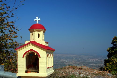
 It is a small historical and picturesque city, 216 kms from Athens, between Messolonghi and Delphi, opposite the Peloponnese. Built amphitheatrically on a hill at 200 metres, it has a small picturesque Venetian port at its foot.
 Beaches: Two glourious golden sand blue flag beaches Psani and Gribovo, endowed giant trees by the seashore and showers and changing room facilities.


.jpg)
 Built on the bank of Lake Pamvotis at an altitude of 500 metres Ioannina is the biggest city of Epirus and the capital city of the prefecture. It is an enchanting city with monuments, cobblestone streets, alleys and traditional market stores that evoke a distinct Ottoman flavour, reminiscent of the rule of Ali Pasha.


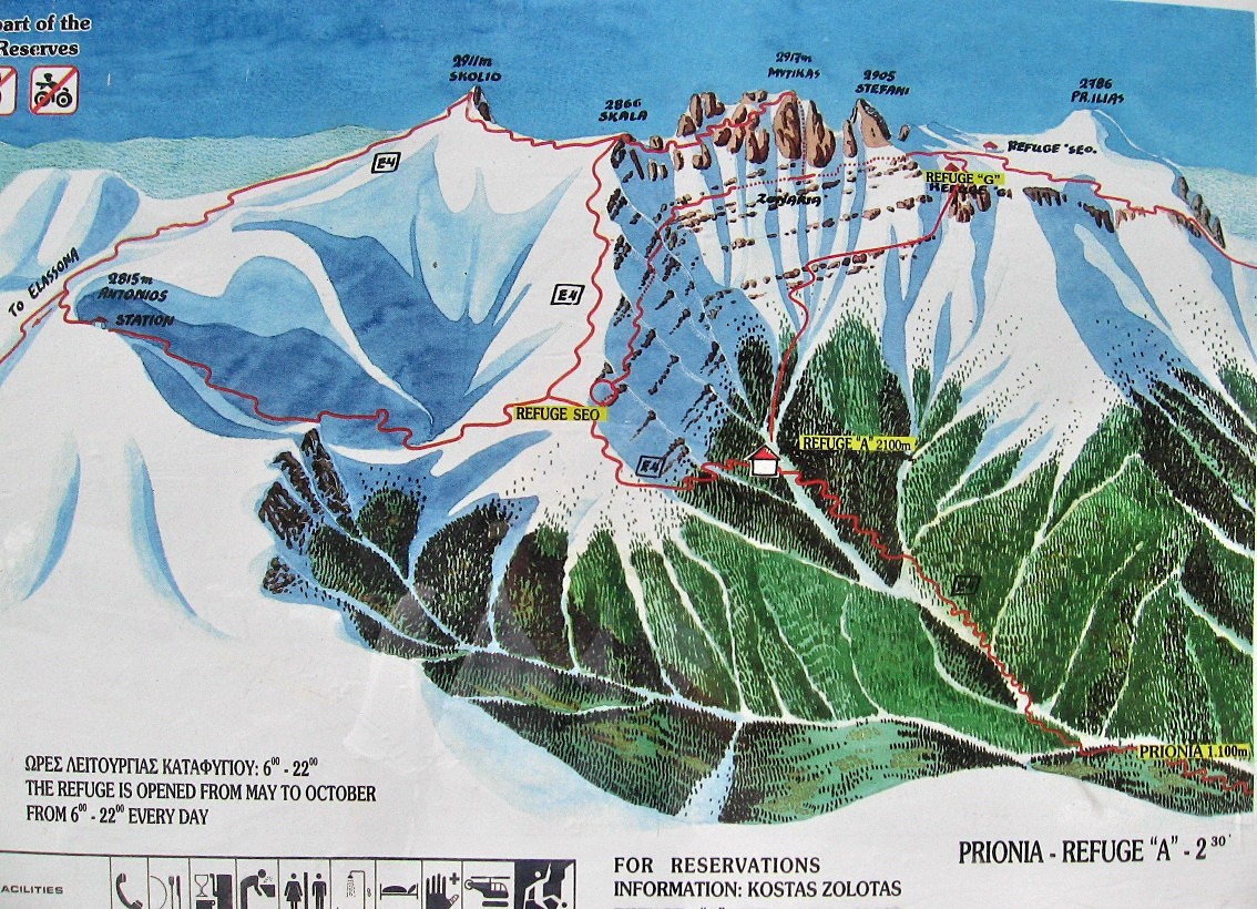
 You can drive all the way up, but it is highly recommended to take the


