Showing posts with label Nature Activities. Show all posts

Thursday, 1 October 2009

Mount Olympus - The Spectacularly Sacred (Macedonia, Greece)

It is Greece's highest mountain and as per Greek mythology, the heavenly abode of the Twelve principal Greek gods (Zeus, the king of the gods, his wife Hera, brothers Poseidon and Hades, sisters Demeter and Hestia and children - Apollo, Artemis, Ares, Aphrodite, Athena, Hermes and Hephaestus).

The ancient sacred site today inspires thousands of hikers from all over the world to tackle the demanding trek to the highest peak in Greece. Once you reach there and take in the magnificence of the range it is easy to comprehend why the ancients chose this site to revere.

The entire area was declared Greece's first national park in 1937 and consists of eight peaks including the "Throne of Zeus" at 2909 metres and Mytikas which has the highest summit at 2919 metres. The park, located 100 kilometres to the south west of Thessaloniki is home to around 1700 plant species, shrouded with pine, beech, oak and cedar forests harbouring wildlife including wolves, bears and lynx. In winter the slopes are buried beneath two metres of snow and are only accessible to the most experienced climbers

HIKING MT OLYMPUS

Most serious climbers can complete the hike to the summit and back in a daytrip. Even for the less experienced two days is a good enough time frame as there are a large number of decent trails. Yet to experience the real magic of Olympus you may contemplate spending some quiet days in the woods.

You don't need any special climbing experience or equipment to take on Mt Olympus but you do need to be fit, properly equipped and have a good head for heights! Yet please don’t take the trek too lightly; it must be remembered that people have died climbing it. So please ensure the following for your own safety:

  • Get a Map from the EOS office in Litohoro or the SEO office. They will provide you with a Greek map but having it is necessary.
  • Warm clothes - even in the summer !!!
  • Good climbing shoes
  • Suncreen
  • Hat / Helmet

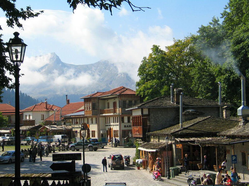
The main base for hikers is the village of Lithoro, on the eastern border of the park. Regular bus services connect the village with Athens and Thessaloniki and there's a train station nine kilometres outside Lithoro.

Stay & Food: There are numerous places to stay including inexpensive hotels and campsites along the coast with good facilities. Lonely Planet recommends Olympios Zeus, Olympus Beach and Minerva. The least expensive hotel is the Markesia. The classiest hotel is the Mirto Hotel on the main square. There are plenty of restaurants and fast food places to eat.

Organized Tours: Most Greek travel agents arrange excursions to Mt Olympus with accommodation included (a hotel bed in Lithoro and a basic bunk in the mountain refuges that provide welcome overnight pit stops for hikers). Climbing Olympus is a major attraction and if you plan without a reservation in July or August you may have difficulty finding a bed for the night.

For sample routes and information you might find these links useful

Mount Olympus Hiking Six Peaks

A Hiking Route for Mt Olympus and Accommodation;

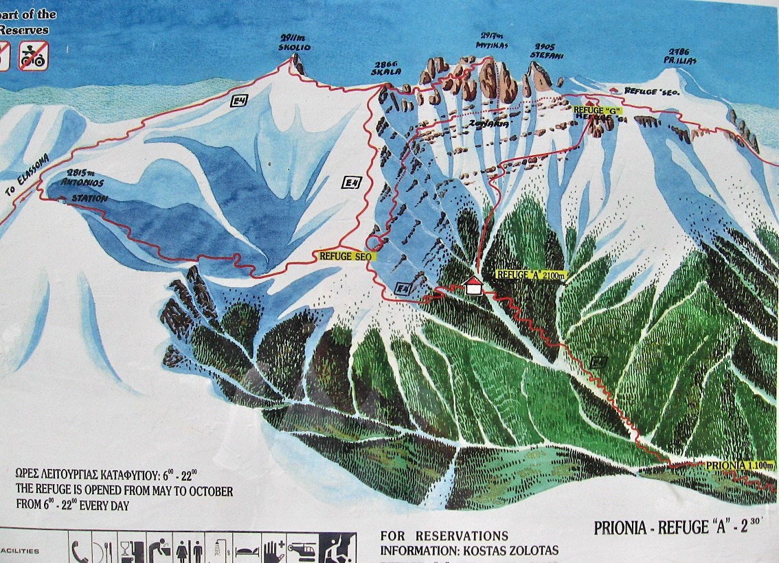
A Basic Map with the Refuges locations

For more information you can buy Lonely Planet's 'Trekking in Greece' or The Rough Guide.

Nearby Attractions
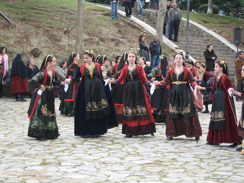
Ancient Dion - Visit the Archaeological Park and Museum at the foot of Mount Olympus. Sacred to the Macedonians, Alexander the great used to make sacrifices to the Gods here before going off to conquer the world. During the August Olympus Festival plays are performed at the restored ancient theatre.

HOW TO REACH

The main base for hikers is the village of Lithoro, on the eastern border of the park

By Car: From Athens OR Thessaloniki it's a relatively easy drive to Mt. Olympus. However, usual cautions about driving in Greece apply.

By Bus: From Athens OR Thessaloniki regular bus services connect the village.

By Train: From Athens OR Thessaloniki there are connections to Lithoro. But the train station is located nine kilometres outside of Lithoro.

Useful links: Matt Barrett's Guide

Metsovo - Enjoying the simplicity of a traditional mountain village (Epirus, Greece)

It is a beautiful traditional village built like an amphitheatre on the slopes of Pindos at an altitude of 1200 metres, at the junction of Epirus, Thessaly and Western Macedonia. It stands on the southern end of northern Pindos and extends between Mt Mavrovouni to the north (altitude 2.160m.) and Mt. Lakmos or Peristeri to the south (altitude 2.295m.), two of the highest mountains of Epirus.

The economy is mostly sustained on traditional occupations namely wood processing (carvings, furniture, iconostases, barrels, beehives etc), cattle breeding, cheese making, agriculture and of late tourism. A visit here is highly recommended if you want to sample a traditional Greek mountain life. Local attractions include churches & monasteries, museums & art galleries, but the real stealer is the traditional way of life that can be experienced here away from the maddening crowds and the natural beauty that surrounds it. The Aoos River which flows to the north and through Albania into the Adriatic Sea rises here and has lead to the creation of an artificial lake.
One of the best ways to enjoy the breathtaking beauty that is inherent to the Region of Epirus is amble on a leisurely pace, enjoying nature's treasures up close and at your own pace.

Nature Activities
We found the following links really useful for the nature based activities that can be pursued here: Walk & Picnic; Go Fishing; Mule & Horse Riding; Skiing; Climbing; Mountain Biking; Off Road Vehicle; Kayaking; Sky Diving; Mountaineering; Cross Country Skiing; River Rafting.

Also Metsovo can be used as a base for excursions to the Nearby Attractions.

Detailed Map of Metsovo; More on Metsovo; About Metsovo; Metsovo history;

HOW TO REACH
By Car - From Athens the shortest route is via Meteora, along the National Road Athens -Trikala (5 hours). About one hour longer is the journey via Ioannina, following the opposite direction along the National Road Athens -Patra.

From Thessalonika the shortest route is via Meteora (about 4 hours/350 kilometres).

From Corfu - after taking the ferry to Igoumenitsa port, you can drive to Metsovo via Ioannina (1 hour and a half).

By Flight - Nearest Domestic Airport is Ioannina post which Metsovo is 50 minutes drive away. There are daily, two flights from Athens to Ioannina (55 minutes) and one flight from Thessalonika to Ioannina (40 minutes). Source http://www.epcon.gr/; More on How to Reach

Traversing the Vikos Gorge & discovering Zagoria, (Epirus, Greece)

The Zagoria region in the Pindos Mountains is a hidden gem where sleepy villages nestle beneath towering pine-clad peaks, and the heat of the summer is tempered with cool mountain air and dips in natural pools. Even at the height of summer, temperatures are pleasant in the high mountains, while dense forest shades the lower canyons.

A hiking heaven it offers spectacular routes through the deep Vikos Gorge which averages 700 metres in depth and is the second longest in Europe after the much busier Samarian Gorge, Crete.
The 12-kilometer gorge itself can be hiked in two or three parts:
  • Monodendri north to Vikos
  • Vikos to Papingo
  • Monodendri south to Kipi

Highlights of a trek through this region includes the deserted monastery of Agia Paraskevi, perched in an eagle's nest position high over the Canyon; the cobbled streets of tiny rural hamlets with their preserved Zagorian styled old mansions, ancient tracks over elegant stone packhorse bridges, the Vaidomatis River that runs through the gorge and the ascent up to Drakolimni (Dragon Lake) which offers breathtaking views out over the mountains and gorges. However it’s recommended not to try hiking alone in this region as it is very easy to get lost and the gorge is still refuge to many wild animals such as bears, boars and birds of prey. Hence it’s best to engage the services of an experienced guide to hike around the Vikos Gorge.

Most trails up the demanding Gamila Massif (2497 metres) are steep and lengthy. Using the Gamila refuge as a base, day hikes can be made to Drakolimni of Gamila, the peaks of Gamila and Astraka and explore the Mega Lakko Ravine. Arrangements for use of the refuge must be made at the EOS office in Megalo Papingo (Tel. 30-265-3041138). They also provide information and maps.

For more information visit the following links:
Map of Zagori Villages; A Vikos Hike Travelogue complete with pictures of the region
The Daily Traveller - The Grand Canyon of Greece; About Zagori; Matt Barrett's Greece Travel;
HOW TO REACH

By Car - From Athens via Ioannina which is a seven hour drive. take the National Highway to Larissa. An excellent primary road travels west from Larissa to Ioannina via Trikala and over the Katara Pass. This portion is an interesting and scenic drive that passes the famous monasteries of Meteora and through gorgeous mountain landscapes. Most of the access roads to Zagoria are located between Metsovo and Konitsa along the main highway from Ioannina to Kastoria. Past Ioannina, the first villages of the Zagori is only 16 kilometres away. However extreme caution needs to be taken while driving as apart from the mountain road being steep, narrow, and winding, local drivers do drive a bit recklessly around hairpin curves.

By Bus - From Athens to Ioannina post that onward connection to the Zagori villages. Do visit the website for more information.

By Flight – Nearest airport Ioannina which is served by domestic connections including flights from Athens

The Best of Epirus Region, Greece (Vikos Gorge & Zagoria, Metsovo, Ioannina, Dodoni, Nekromanteion


Epirus has the strongest regional identity in mainland Greece, bordering the peripheries of West Macedonia and Thessaly to the east, Central Greece to the south, the Ionian Sea and the Ionian Islands to the west and Albania to the north.

It owes its character to an unrelenting mountainous terrain (Pindus Range), forested gorges & wild rivers. These natural fortifications have been successful in protecting and isolating the region from outside interventions, even to a great extent from the Ottoman Rule. Their roles in ancient Greek affairs were relatively insignificant with only four archaeological sites of any importance, out of which two are isolated Oracles. But the regions attraction lies in its sheer physical beauty with limestone peaks and dense forests which provides an enchanting background to traditional stone built villages and arched packhorse bridges. Areas of interest in this region of Greece would include

Nature Trails

  • Vikos Gorge & Zagoria - The deepest gorge in the world by the Guinness Book of Records, it offers a landscape of awesome beauty, as the walls of the canyon reach at some points the height of 1 kilometre and the crystal clear waters of Voidomatis River run through it in a spectacular route.
  • Up on the mountains of Pindus some 45 picturesque villages called Zagoria or Zagorohoria offer unforgettable images to the visitor: traditional architecture and a unique folkloric character, countless centuries-old bridges and water fountains, cobble-stone meandering streets and passages, stone-built churches and tiny chapels and Mount Tymfi with its highest peak Gamila & Smolikas for the serious and seasoned trekkers.
  • Metsovo (County of Ioannina) - an easily accessible charming village and should be visited if you want to savour the taste of Greek mountain life

Archaeological & Historic Interests

  • Archaeological site of Dodoni Oracle - The oldest Hellenic oracle, dedicated to Zeus and the Mother Goddess. The site also includes an amphitheatre dating to the 3rd century BC.
    Lakeside town of Ioannina - It is the historical, cultural and commercial hub of the Epirus region. It was the capital of the tyrant Ali Pasha. The old town is strewn by the remains of the Ottoman quarters (the mosque, old fortifications) Ottoman-flavored bazaar and inexpensive eateries rimming the lake.

Ancient Nekromanteion, Oracle of the Dead (County of Preveza) - Located on a cliff near the shores of the lake Acherousia, at the junction of the rivers Kokytos and Acheron. According to the ancient Greek mythology, the Acheron river (‘river of woe’) was a branch of the underworld river Styx over which Charon ferried the newly dead souls across into Hades. So it is here, at the Nekromanteion, that the ancients believed were the Gates to the Dead. (Spooky)

Wednesday, 30 September 2009

Lake Plastiras - Thessaly, Greece


Set at an altitude of about 800 meters in the Agrafa mountain range, the man-made Lake Plastiras and its surrounding area is offers spectacular natural beauty and magnificent views.

Outdoors Activities:
It offers you the opportunity to walk, drive or bike along fir, oak and chestnut trees, down shady lanes with openings to views of immense height and the vast plains below. Fishing, sailing, kayaking, river rafting, hiking, horseback riding, mountain climbing, cross country skiing and jeep tours are other options available.

There are several small villages surrounding the lake. The villages of Kryoneri and Kalivia are well developed for tourism and here you will find hiking tracks, hotels, places to rent sports equipments, organized outdoor areas and the beaches of the lake. The tourist haven and best-known village, Neochori, is worth visiting as it was built on a slope and offers the best views of the lake.
You can buy local products (like honey, spoon sweets, frumenty, garden products, wine, raki and more) from the producers of the region along the road.

Important monuments and places of interest in the wider region includes the Monastery of Korona, Pelekiti and Petra, and the Gaki and the Kaimakia Caves.